- English
Languages:
This site is created using Wikimapia data. Wikimapia is an open-content collaborative map project contributed by volunteers around the world. It contains information about 32523427 places and counting.
Learn more about Wikimapia and cityguides.
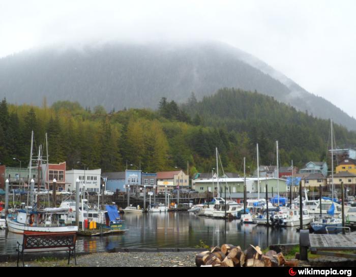
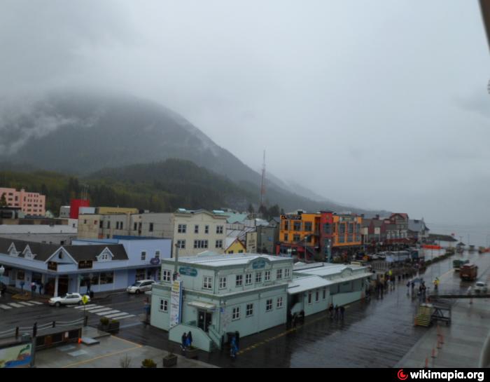
Ketchikan, Alaska
Ketchikan is a city on Revillagigedo Island in Ketchikan Gateway Borough, Alaska. The population was 7,368 at the 2010 census.
Ketchikan was first settled by Alaska Natives as a fishing enclave. White settlers built a thriving logging industry, but the city's last major pulp mill shut down in 1997, and nearly 500 jobs were lost.
Ketchikan is located on Revillagigedo Island, about 35 miles wide and 55 miles long, a stretch of rugged hills, mountains and spruce. Residents talk of reaching into the clear water and grabbing wriggling salmon with their bare hands. Locals drink rainwater, rarely use umbrellas and hide their garbage from black bears. It is a place where many residents own boats, and the 600-student high school mascot is the king salmon.
Tourism is now Ketchikan's main source of income, with 1 million visitors annually. Between May and September, cruise ships stop daily - often several at a time - unloading passengers to admire the abundance of totem poles and stop at the dozens of stores selling necklaces and earrings made of gold nuggets and violet-blue tanzanite.
Trivia:
* One of Ketchikan's landmarks is Creek Street, a former red light district.
* Ketchikan has the heaviest average rainfall in North America, and therefore measures its rainfall in feet, not inches. Like many towns in Alaska, Ketchikan refers to precipitation as "Liquid Sunshine."
* Much of the town sits over water, supported by piles.
* The town was certified in 2005 as the fourth wettest spot on earth, with nearly 200 inches (5100 mm) of rain (the general range is 130-170 inches/3300-4300 mm)
* Ketchikan has the highest ZIP code in the United States: 99950 for post office boxes. Nearby Ward Cove is 99928. Ketchikan's street delivery ZIP code is 99901.
* The sudden influx of jewelry stores in the downtown area (over 70 in one square mile by some estimates) has caused locals to dub the city "The St. Croix of the West Coast."
* For a period of time the local middle school was moved to the former Bon Marche in the Plaza shopping mall because of mold contamination. The middle school currently operates out of Ketchikan High School and other schools in the city while the multi-million dollar repairs are carried out.
* In August, 2005 the 2005 Highway Bill provided for $223m in subsidies to build a bridge nearly as long as the Golden Gate Bridge (dubbed by critics as the "Bridge to Nowhere") between Ketchikan and nearby Gravina Island (population: 50). The subsidies were negotiated by Alaska's Rep. Don Young. It was hoped that the bridge would help spawn development on the island, which houses the city's airport.
Wikipedia article: http://en.wikipedia.org/wiki/Ketchikan,_Alaska
Ketchikan is a city on Revillagigedo Island in Ketchikan Gateway Borough, Alaska. The population was 7,368 at the 2010 census.
Ketchikan was first settled by Alaska Natives as a fishing enclave. White settlers built a thriving logging industry, but the city's last major pulp mill shut down in 1997, and nearly 500 jobs were lost.
Ketchikan is located on Revillagigedo Island, about 35 miles wide and 55 miles long, a stretch of rugged hills, mountains and spruce. Residents talk of reaching into the clear water and grabbing wriggling salmon with their bare hands. Locals drink rainwater, rarely use umbrellas and hide their garbage from black bears. It is a place where many residents own boats,...
 Reduce description
Ketchikan, Alaska on the map.
Recent city comments: